Saturday, May 11, 2013

Sharavati Part 2 - Thumbe falls


King Julian from planet “ who cares” accompanied us to our many expeditions… He had joined hands with the Gypsies to find his spaceship. The search had begun!

It was on a perfectly hot mid-summer day that we trekked to the Thumbe falls in the Sharavati river valley. Our guides lead us on a steep, slippery way through dense vegetation towards the falls. The trek trail was characteristic of a typically difficult path which would become completely inaccessible in the monsoons. The trek trail was a very steep ascend for some part and an equally steep descend for the others. The narrow path was strewn with a thick layer of dry leaves. We had to tread carefully as the dry leaves made it impossible to guess what lay underneath. A single wrong footing and we would go tumbling down like the Jack who went to fetch a pail of water! The trek trail snaked through a thick forest and we walked ahead cautiously holding on to the trees along the path and preferring to slide down occasionally to keep our balance. After about 45 minutes, a stream of water came into sight. We crossed a huge tree trunk which lay across the stream .Thence; we started following the rocks along the water stream to reach our destination.

treading on the steep path strewn with dry leaves

we followed the water...

The tree bridge

I distinctly remember a twist in this rocky trail. We thought we would need to jump into the water and swim to the next walkable rock. However even that seemed impossible as getting into the water meant diving from quite a height and with all our luggage, that would not have been a wise thing to do. Our guides made us climb on to the rocky wall that guarded the edges on one side of the stream, holding onto the tree roots and the small crevices in the rocks. We struggled there as the path was only wide enough to place one foot. Moreover we were holding onto tree roots and the creepers hanging from the branches above to keep ourselves from sliding down and crashing into the water! This exciting ordeal ended in just about 15 minutes and we were back following the rocks again. After about 10 minutes, we reached one of the tiers of the Thumbe falls which made a pool several feet deep. This was going to be our lunch place that day and most of us were too happy to take a dip in the water after the ardeous trek. However we had not yet reached the head of the Thumbe falls.

Climbing on the rocky ledge

On the way to the destination

On the way to the destination2


We had been trekking for nearly 3 hours and by now everyone was exhausted to undertake the journey any further. Moreover, the trek trail had become more of a rock climbing exercise with each passing step. So most of us settled there and were more than happy to laze around the water. Even though the journey is the best part when you set out on a destination, it is reaching the destination that gives you a sense of accomplishment! Five gypsies however decided to go ahead to the actual destination. We got a warning from our leaders to return back in an hour so as to reach the base camp before sundown.

Our guides left their cooking gear near the first tier and we set off. We jumped and climbed rocks for another 30 minutes. Soon we were at the head of the great Thumbe falls. We were standing on top of a vertical drop of nearly 100 feet. From the place where we stood, we could only hear the roar of the water crashing at its feet. We couldn’t see the falls. All along the water stream, the trees had caved in and from our point of view it looked like a long tunnel through which the waterfall escaped from the rocky ledge on which we were presently stationed. We cautiously moved along the edges on the slippery rocks just to catch a glimpse of the waterfall. It would have been the perfect place for rappelling if we had the gear. However without any ropes, we were in a treacherous position where a single wrong step would prove fatal. Unfortunately, since we were warned about the difficulty of the path, we didn’t carry a camera and thus missed capturing memories of this breathtaking scene!

We jumped and climbed rocks again to reach the place where our fellow trekkers were waiting for us.
Our guides prepared a sumptuous meal of rice and sambhar accompanied by papad and pickle. It seemed to be one of the tastiest meals after the tiring trek. We relaxed in the cool water for some time and then around 3:30p.m began the tough trek back to the start where our TT was waiting for us. Varun was still to arrive. So we did a round of introductions amongst ourselves as is the ritual among the Gypsies till he arrived. He did come soon limping with cramps and carrying the many encouraging words from Ashwin!


Our resting place. Unfortunately, 
none of us carried a camera to capture the main falls.

Sharavati Part 1 - Off to Sharavati... In search of a lost spaceship!


King Julian’s spaceship had crashed on Earth. We, the Gypsies, who had formed an alliance with him long time ago, to prevent invasions from the outer space on Earth. We had sworn to help him find his spaceship…

It was after a month long hiatus(thanks to the annual sports event-Synergy at Infosys, Mangalore) that we had set out to be the real "Gypsies" again. Walk away from the air-conditioned workplace and live free - with the hard ground beneath and the open sky above! So on the day, the Synergy results came out, and the winners walked away with awards, we set out on an expedition to Sharavati river valley and have our share of summer fun. All of us from Mangalore gathered at Mangala at 11p.m. sharp to begin our trip to Sharavati.
As soon as the journey by TT started, most of us hit the sacks tired by the tension and exhilaration that Synergy brings in its wake! We came out of our slumber at 1a.m. when we halted at the Marvanthe beach. At night, Marvanthe beach is a sight to behold! Especially on a full moon night, a poet would be inspired to spin out a few verses to praise its beauty. Fortunately for us the full moon day was only a couple of days away, and the moon was "almost" full that night!


The Marvanthe beach, 2 days before the full moon day


The moonlight cast a perfect radiance in the sea, making the seemingly dark sea glitter . The silence of the night and the sound of the waves crushing against the shore add to its charm. We sat there for some time sipping piping hot tea , from a small shack which is open all night long for travelers, enjoying the cool breeze and basking in the beauty of the moment!

Once we were in the TT, the hot tea failed to keep us awake, and all of us were again dead asleep, except Ram, who sat chatting with the driver! At around 4 a.m. the TT ride started turning bumpy and neck breaking for the sleeping beauties/hunks in it. After losing our way once, and then setting out on the bumpy ride again, we arrived at our destination at 4:40 a.m. It was pitch dark outside. We spent the next couple of hours before sunrise sleeping peacefully in our van.

The Sharavati wildlife sanctuary is located near the town of Kargal about 150 kms from Mangalore and in the Shimoga district of Karnataka near Mupanne. The sanctuary houses the backwaters made due to the Linganamakki dam reservoir. We were set to spend a couple of days in this beautiful place.

The Gypsies at Sharavati

Though it was mentioned in the mail being sent before every trek to bring a plate, glass and spoon, most of us had forgotten these vital equipments. Thus we had to share 4 glasses and 3 plates among 14 people. Our fellow trekkers from Bangalore Karanth, Achalesh, Ankit and Varun joined us. Just before the trek, Nitin had mentioned in a mail that “It’s always guys from Bangalore!" There was no reply to this mail! However, the Bangalore boys were , this time , accompanied by a couple of girls - Sutonuka and Aparna - both avid trekkers. They were also accompanied by a certain King Julian who was in search for his lost spaceship. He strongly suspected that it must have crashed from the outer space somewhere near Sharavati…

After a simple but nourishing breakfast of idlis and rasam, we were off to a trek to the Thumbe falls. 

breakfast at the base camp

..... to be continued

Saturday, February 16, 2013

Kumbhakallu - lost & spiritual!


A number of imageries were streaming through my mind when the twin peaks of Kumbhkallu came into sight. Did they resemble the horns of an animal? Or was it a victory sign being flashed by the mountains of the Charmadis? Were the peaks so arranged because nature wanted to point towards something in the depths of the mountains? I think my imagination was just running haywire when I saw those two peaks forming a valley between them like the alphabet “M” ?!
The twin peaks of Kumbhakallu


As we approached Kumbhakallu

When Fahad had planned this trek, Kumbhkallu appeared to be some lost peak in the Charmadis. The great Google had very little reference for this place. Fahad and Nitin had to call up an avid trekker - Dinesh Holla of the Youth Hostel Association (YHA) to gather information about this lesser known peak in the Charmadis.

So, before the crack of dawn on the 3rd of February, armed with food, water, cameras, sun-protection gear, lots of energy and a guide (so as not to get lost in the wilderness), we set out to conquer the Kumbhkallu. We were on our way to explore a lost peak and yet we lost our way to its base only once! We enquired around and after obtaining permission from a private estate, on whose land we were about to encroach, we started towards our destination. The beginning of the trek slopped gradually upwards on a very dusty, motorable path; winding through a few private estates. All along this way we were welcomed by barking dogs! After this, the trek trail transitioned from a dense forest to sunny grasslands. The last of the houses along this way was where the guide started with us to the Kumbhakallu. After about 15 more minutes of walking along the same way, we took an abrupt left to enter the dense forest. The trail was only getting steeper with each step. The sprawling vegetation whose branches and roots we had to brush aside to walk , made ascend even more difficult. This distance must have been at most 2kms. But the kind of effort it extracted from us necessitated taking numerous pit stops to replenish our energy.

on the steep motorable road

The beginning of the trail

Through thick dense forests


 Throughout the next kilometer we had to battle grass, which was sharp edged, shoulder length and hiding some thorny shrubs too! It was through this grass that we were making our own path under the expert guidance of our guide. The steep path made it impossible to climb without holding onto the grass and our hands were soon covered with bruises.
Through the "sharp" grass


When this “sharp” trail ended and a clearing came into sight, we were staring at a rocky barren slope at an 80-degree incline. The peak was nowhere in sight and the end of this wall in front was not visible. Our guides climbed up on all four limbs…like monkeys; and so did we! Huffing, panting, stumbling and scrambling for footholds and handholds in the rocks, we gradually moved ahead on the seemingly never-ending slope. After a long time, the peaks came into sight again– all rocky, barren and sunny with hints of thorns and grass blades. By the time we reached the shorter of the two peaks, we were out of breath but brimming with a sense of achievement!
rock climbing

the exciting rock climbing contd...


The top of both the peaks of Kumbhakallu houses a holy cross. Our guide informed us that Kumbhakallu is a sacred place and locals visit this peak on Good Friday. That is when the grass in the valley between the mountains is burnt and cleared for easy access to the peaks. This peak also offered a spectacular view of the Charmadi peaks – the Erikallu, the Minchukallu, the Amedikallu, the Kodekallu (which looked like a huge egg resting cozying on a mountain top) and the Balekalle. After informing us about the descend path, our guides left us to explore this mystic peak.
The Kodekallu from Kumbhkallu


A few of us climbed up on the other twin, the higher one, as well and enjoyed the amazing feeling of being on the top of the world yet again…This time with the Lord besides us! All this time the sun was right above our heads and on the top of Kumbhkallu there is absolutely no shelter.  We had lunch in burning afternoon heat. (Thanks to Prachi and Sujith for getting umbrellas!) Our water supplies were depleting very fast and we had not even started to decend!

remember 127 hours?

The Lord's presence on Kumbhakallu

On top of the world at Kumbhakallu

Descend proved to be more challenging than expected. We went down the valley between the twin peaks. We were struggling against tall, sharp, abundant grass and an uneven and steep terrain along with the burning sun! Surviving on packs of glucose and oranges, since water was a scarcity, we proceeded ahead; a few of us braving cramps and fatigue. It was a great relief when the grassy stretch ended and we entered the forest. At least, the sun stopped smoldering our head! We reached the first estate at around 5p.m. in the evening, all tired and bruised. Thankfully there was clean water there and we could replenish our dehydrated systems and freshen up ourselves! Around 6.30p.m we started on our journey back to Mangalore and finished the day with a sumptuous meal at Rinku da Dhaba!
Getting down the grassy valley seemed 
much tougher than climbing up the rocks! 


P.S.:
Arun had a peaceful sleep on top of Kumbhakallu… so much so that he started snoring!

Prachi kept falling in the grass again and again, crushing it under her weight and clearing the way for those behind her…she “earned” the name “bulldozer” for her efforts!

On our way back, about a kilometer before completing our trek, Yashash and Arun who were battling with cramps and dehydration tried to break open a pipeline running along the way for a drop of water. Thankfully they didn’t succeed!

Giri, as usual, made sure that he was the most photographed Gypsy of the day!

And finally, this was Fahad’s last trek with the Gypsies before leaving Infy and getting ready to explore new avenues in the States. This was also Fairoz’s last and probably the most difficult trek, which she managed most admirably… We'll miss both of you!!

Monday, January 28, 2013

Ballalrayana Durga and Alekkan Falls


It’s the time to share my experience of yet another alluring destination in Karnataka - the secluded Ballalrayana Durga! Ballalrayana Durga confines in its ruins, the memories and legends of the great men, who ruled Karnataka once upon a time. To this day, Ballalrayana Durga seems to be shrouded in an aura of the bygone era. All I know about the history of this fort is that it was built by Ballal raya(there are Ballal I, II and III. No idea which one built it!) and that it was later captured by Tipu Sultan. We started from Mangalore at 5.15 a.m. on a weekend to explore this seemingly alluring fort.

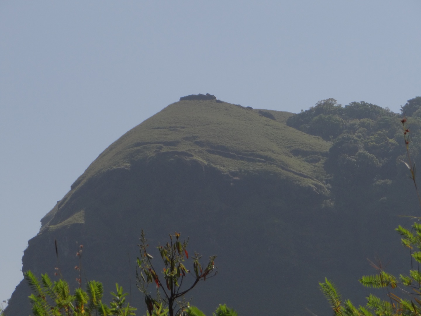
Ballalrayana Durga as seen from the 
starting point of the trek

The fort walls being seen along the hill.


There are two routes to reach Ballalrayana Durga – via Ujire and via Sunkasale. En route the fort via Ujire you come across the Bhandjje falls. This is however a tough uphill ascend of more than 10km. and may not be possible in a single day.
We took the Sunkasale route, which is much shorter and easier as we had only a single day at our disposal. A three-hour drive through the scenic Charmadi Ghats took us to Sunkasale. At the starting point of the trek lies an old Kalabhairava temple. It is said that this temple has also been built at the same time as the fort.
As is a routine now with every trek, there has to be a surprise awaiting the Gypsies! This time the surprise came in the form of a tractor ride from the temple along a very kutcha but motorable road.

It all started when a tractor attached with a carrier came and halted in front of us as we were preparing to begin the trek; courtesy some labourers who were transporting soil in the carrier. Needless to say, a photo shoot followed where the tractor was the celebrity! The labourers offered to drop us till the point they went along the trek route to pick soil. We were too happy to oblige. Soon all the Gypsies were in the carrier of the truck, enjoying a bumpy ride along a bumpy road. It was like volunteering to sit on a machine made to administer birthday bumps! Every moment we were being tossed up a few centimeters in the air and were then landing with a thud back in the carrier. The constant vibrations were displacing our sun protection gear. Hats were falling off and sunglasses rattled on the nose. In the melee of vibrations, a water bottle escaped to freedom from the confines of a bag’s side pocket. A labourer found it lying on the road and handed it over to us. Truly, a worthy beginning to our trek!

A memorable tractor ride!


The next couple of hours were spent ascending through forests for some time and then following a curvy path in the vast sunny grasslands. The fort walls, which looked like a thin line drawn across the peak, beckoned us silently all along the way. The fort walls extend over a couple of kilometers in the endless stretch of grass -that is all that remains of the fort. Along the wall, a few circular watch points are built at strategic locations, which offer an unhindered view of the town below along with the many approach roads to the fort. Undoubtedly, this must have been a strategic location in the olden days! From the fort, you can also see all four peaks in the Charmadi ranges. After an hour of exploring the fort we started back to our base. We visited the ancient temple, which had signified the start of our trek and started on our way back to Mangalore stopping only for a photo shoot in a sprawling tea estates a few kilometres away and then, to visit the Alekkan falls situated along highway passing through the Charmadi Ghat.

Trekking through the sunny grasslands.

The tea estate a few kilometers
 from the Kalabhairava temple

A watch point at the fort.


Visiting the Alekkan falls was yet another adventure. We had to go down the highway into the valley along a very steep and slippery descend for about 200 meters. From where we were standing, the way to the falls looked too difficult. We stood there contemplating how to go down; and if we manage to go down, how can we climb up again! It was the proverbial “So close yet so far” situation! But we were not the ones to give up… slidding and falling, slowly and cautiously we decended to reach the Alekkan falls. The Alekkan falls flow through the Charmadis from one side of the highway to another. A manhole has been constructed under the road to allow the water to flow without any obstacles. On the other side, when we went down the valley, we could never guess that the waterfall flows beneath a cement and concrete road. Even so long after the monsoons, the water flow was quite strong. Alekkan, though, bears the burnt of being situated so close to the higway – it is littered by the usual culprits – loads of plastic…
Climbing up to reach the highway was much easier than we had anticipated! Soon we were back on our way home after a day well spent exploring nature and the relics from history. 

The Kalabhairava temple.

The steep decent to the Alekkan falls.

Alekkan Falls

Gypsies at the Alekkan falls

Date : 19th January, 2013
With: Fahad A.R, Achalesh J, Mahesh, Fairoz, Giri Tanari, Sahana Varadraj, Vidya, Nachiket, Charan Walke, Shubham, Sarath Gopeenathan, Venugopal, Suchit, Aditi, 

Sunday, January 6, 2013

A surprising Ermayee

Waterfalls are a pleasure to watch when they are flowing aggressively during the peak of monsoons. The falling water appears dangerous then, threatening to swallow anyone who dares to go too close to it. When we visit waterfalls in the monsoon to witness the power they have acquired from the dark clouds above, little do we realize that the turbulent opaque whitesheet of water must have hidden a chest full of treasure behind it! Perhaps the rough water also prevents us from witnessing the chiseled beauty in the rocks that support its flow!

The rocky bed of a waterfall is known to form due to erosion by the strong water currents and the stones and sand carried by it. Many times a shallow cave-like formation is formed behind the waterfall due to a processknown as “splashback” of water. This cave like formation is known as a “rock-shelter”. Moreover, when the water pounds forcefully on the rocks at its base, a deep plunge pool is formed due to the continuous erosion.

In monsoons, the turbulent waters of Ermayee falls hide numerous rock shelters, which are inaccessible then. Early in winter when the force of the water lessens, one can easily see that the bedrock has been carved out intricately to resemble a five-storied gorge-shaped structure - the rock shelters forming the five storeys in that structure, with the water flowingforcefully in the bend of the gorge. It being midwinters, the surrounding bedrock was not wet or slippery. We managed to find a way to enter one of the rock shelters with a slight struggle to climb up the steep rocks, which had verynarrow holds at some places. We climbed easily to about 30 meters on the rock and then had to move horizontally for the next 30 meters along it using only the narrow holds for support. The footholds were only a couple of inches wide at some places. It was a bit risky, lest someone should lose their grip andfall 30 meters below on the rocks. We moved cautiously, helping each other.Once on the “third storey”, we crouched to get into the rock shelter.

Climbing up to the rock shelter was worth the effort! I cannot fully describe the exhilaration of being behind the waterfall without getting wet! There were two rainbows parallel to each other in the sheet ofwater. You can imagine the beautiful photographs we got clicked by someone at the base of the falls, as we posed behind the translucent sheet of water broken at some places due to deformities in the rock; with a couple of rainbows in the water in front of us!

Later we were in for another pleasant and beautiful surprise. When you climb to the terrace of the falls, you reach yet anothersmaller waterfall. The water of this falls appears to be flowing through a roofless cave (at times the water flow becomes even lower making this sheltered spot a perfect one to camp at!) The climb to the terrace of the Ermayee falls, though, is treacherous due to the numerous vertical rocks, having very little holds, along which we needed to move very cautiously. Climbing to the terrace is not possible in the monsoons. A water pipeline runs through the topmost falls to the base of Ermayee falls. At the terrace, a bund has been built due to which, a nearly 20 feet deep pool has been formed. A few ropes have beentied along the rocky climb to the terrace, probably to assist workers to beable to climb to the pipeline. After spending sometime with this surprise at the Ermayee, we headed back to Mangalore!

The Ermayee falls had turned out to be more of an adventurous surprise…! We felt really lucky to have had this spectacular experience!
Climb along to rocks to 
the rock shelters

The Ermayee Falls flowing through
a gorge

In the rock shelters

The treacherous climb

Bliss in a cave!

The source of the falls through a closed cave

On the top of Ermayee

Climbing up to the top
(Photographs courtesy Charan S.Walke)

Ermayee Falls in Monsoons of 2008 
and winter of 2012 courtesy Fahad A.R.

Route: Mangalore- Belthangady-Ujire
Date: 29th December, 2012

With: Fahad A.R, Nitin Shettigar, Ramaprasad, KarthikPrabhu, Manoj, Smitha Upadya, Arun Mysore, Aditi Vishwasrao, Vikram Kaparthy, Javid Karangi, Abhilash Desai, Fairoz Fahad, Madhu Ramaya, Prachi Bhosale

Butterflies in my way! Aanadka Falls

Nature never ceases to surprise us! We climb mountains, cross the oceans and fly in the open skies thinking that we have “conquered” nature. The truth is that nature always “conquers” us… by unraveling the many mysteries she has hidden within her depths. Numerous such surprises were thrown at us when we, the Gypsies, trekked to the Aanadka falls (also called Kudumagundi falls) in the Kudremukh National Park.


Trekking through thick forests to Aanadka Falls

The Aanadka Falls


After trekking to Kudumari falls and then to Kumara Parvata on successive weekends, the trek to Aanadka falls was destined to be clear sailing. Surprises started even before the trek began. These were the surprises thrown by “human nature”. The Gypsies ritual of waking up fellow trekkers by giving them a wake-up call was broken when the Gypsy in-charge of this “tough” job failed to execute it. The result being many gypsies turned up for the trek without taking a bath! We halted, as usual, for breakfast at an eatery on B.C. road. The relaxing nature of the trek was such that we forgot to pack lunch and it was too late when we realized that!
More surprises waited as we reached the Kudremukh National Park…the forest officials (unfortunately for them), had kept the checkpoint office shut; thus missing out on what could have formed, a major chunk of their earning that fateful day!

The trek trail passed through a couple of sprawling village estates, streams and thick forest. We were moving ahead cautiously due to the dense vegetation and thorny shrubs lining the trail. There was no wind and the vegetation was not allowing the sunlight to stream through it. The quietness of the forest was disturbed only by the occasional jingle of the flowing stream and by our footsteps crushing the dried leaves along the trail. It seemed as if we were the only moving creatures there. Nature proved us wrong again as it threw up a really pleasant surprise….

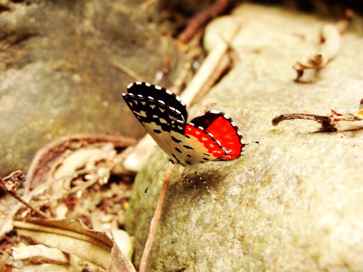
After crossing the first stream, a flurry of activity rose through the vegetation with our every step…the butterflies!! The trees along the trail were inhabited with thousands of butterflies. Every step we took shook a hundred butterflies from their peaceful slumber and they hovered excitedly around us; like glittering angels arising as a result of some magical charm. The Western Ghats is known to be home to hundreds of species of butterflies. These were the “tiger” species – the common tiger that has flame colored wings with brown border and the blue tiger that is black in color with closely placed sky blue spots on the wings. We had a wildlife enthusiast, Arun, with us and he also spotted a few other species in that melee of colorful wings - The common crow, the spotted kites and the common jezebel. We heard a peafowl screaming, “may-awe”, saw many parrots and parakeets, the sun bird, the red-whiskered bulbul and the green bee eater among others. The trail to Aandka falls was also a nature trail buzzing with variety.

A tree full of butterflies

A bettle with a pattern of human face on it


(Photographs courtesy Charan S. Walke)

Aandka falls in monsoons of 2008 and 
winters of 2012 courtesy Fahad A.R.

The butterflies welcomed us hostilely as we approached the waterfall, resting only after we had left their territory. We were enjoying the numerous colorful wings swarming us as we moved ahead! 

As it was almost the end of December, the water currents were not very strong and we could stand right under the water flow or go behind it. The rocks over which the water flowed when in full flow, were now exposed. They had a slippery layer of moss and lichen covering them. This was enough to lower the friction and make a couple of us slip again and again until they hurt their behinds!

After frolicking around in the falls for an hour and having a minimal lunch of snacks, biscuits and oranges we were ready to return to Mangalore. That is when Fahad suggested that we had plenty of time to visit another falls – Ermayee that was close by and was just about a kilometer and a half trek . The rest of us were more than happy to agree!


Route: Mangalore-Belthangady-Ujire-Kudremukh National Park


Date: 29th December, 2012

With: Fahad A.R, Nitin Shettigar, Ramaprasad, KarthikPrabhu, Manoj, Smitha Upadya, Arun Mysore, Aditi Vishwasrao, Vikram Kaparthy, Javid Karangi, Abhilash Desai, Fairoz Fahad, Madhu Ramaya, Prachi Bhosale